Property Research
Here, you can explore some of the documents in our archive collection related to historic properties in Grinnell. This is not a complete list of all our resources, but this page is a good starting point which includes some of our most commonly used materials. Several of these resources were compiled by volunteers when the residential district west of Grinnell College was added to the National Registry of Historic Places.
We have specific information in this collection for about 20% of Grinnell residential properties and information on the former owners for most residential properties. The commercial district and the historic district on the north side of town are the areas with the most available information.
Can’t find what you’re looking for on this page? You can try searching your address (house number and street) in Digital Grinnell or in the blog Grinnell Stories. Or, for more resources, check out our Archive Repository page, our Oral Histories page, our Obituary Database, or our Poweshiek History Preservation Project page.
Documents on Grinnell Architecture
Domestic Architecture in Grinnell- 1854 to World War I
Includes a narrative summary of some houses like the Sumner Bixby house, the Grinnell Historical Museum, and others, along with the resources consulted in the document, and a list of the history of 15 specific homes on East Street, Park Street, First Avenue, Fourth Avenue, Main Street, and Broad Street. Written by Pat Murphy in 1976. 30 pages.
Early Grinnell Architects and Builders (2008)
This is a quick reference guide put together by the library archivist. It includes short descriptions of architects, where they were based, and the buildings they designed; mainly commercial buildings, including Bartlett, Benjamin J.; Eastman, Charles Edward; Holsman, Henry K.; Proudfood, Bird and Rawson; and Coutts, Robert G.; and many others. Includes 6 images in 30 pages.
Grinnell Commercial District Expansion Application (2013)
“National Register of Historic Places Registration Form” for Grinnell Historic Commercial District Boundary Increase, includes function and use description, previously non-contributing buildings that have been re-evaluated, a resource tabulation and evaluation summary of addresses, styles, and building dates, statement of significance, added district buildings, and a table of Grinnell Commercial Historic District property owners, also includes various photos and maps, 183 pages
Grinnell Commercial District National Registry of Historic Places Documentation (1989)
“National Register of Historic Places Registration Form” for the Grinnell Historic Commercial District, roughly bounded by Main, Broad, Commercial, and Fifth Avenue; includes introduction; massing, variety of composition, physical condition summary; a history of the area from 1870 to 1989; typology of buildings, individual site descriptions; and maps and images; 65 pages
North Grinnell Historic District Application (2013)
“The Historical Residential Development of Grinnell, Poweshiek County, Iowa, 1855-1958,” by James E. Jacobsen with the History Pays! Historic Preservation Consulting Firm in Des Moines, Iowa, includes an introduction, Grinnell’s history and development, and individual and district residential property eligibility recommendations, graphs, maps, tables, and other images, 50 pages
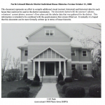
North Grinnell Historic District Photos (2008)
“North Grinnell Historic District Individual House Histories,” includes photos, floor-plans, clips of books, and written descriptions, 355 pages
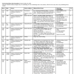
North Grinnell Historic District Spreadsheet of Properties (2008)
“North Grinnell House Data Spreadsheet,” for each house, includes date, owner, style, architect, history/first owner, materials/outbuildings, and evaluation (contributing or non-contributing), 14 pages
County Records Search
Poweshiek County Assessors Information Search
Search by name or address for current information and limited history, includes an interactive map
Maps and Directories
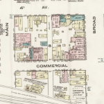
1883, 1888, 1893, 1898, 1906, 1911, 1922, and 1932 Sanborn Insurance Maps
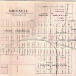
Sanborn fire insurance maps from 1883, 1888, 1893, 1898, 1906, 1911, 1922, 1932, of Grinnell, available from Library of Congress website, 102 images
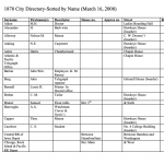
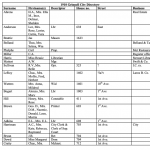
1878 City Directory
“1878 City Directory-Sorted by Name (March 16, 2008),” transcribed data, table includes surname, first name(s), descriptor, house number, street, and business, 32 pages
1894-1895 City Directory Data
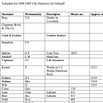
“Template for 1894-1895 City Directory for Grinnell,” transcribed data, table includes surname, first name(s), descriptor, house number, street, and business, 53 pages
1896 Atlas of Poweshiek County Plat Book
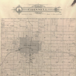
“Atlas of Poweshiek County, Iowa, 1896,” images available from Iowa Digital Library, includes township maps, town plats, maps of Iowa, the world, portraits, and other supplemental information, 55 images
1900 Grinnell City Directory
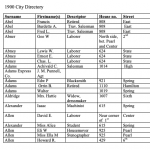
“1900 City Directory,” transcribed data, table includes surname, first name(s), descriptor, house number, street, and business, 81 pages
1910 Grinnell City Directory
“1910 Grinnell City Directory,” transcribed data, table includes surname, first name(s), descriptor, house number, street, and business, 89 pages
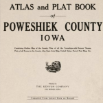
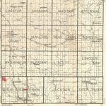
1914 Poweshiek County Plat Book
Atlas and Plat Book of Poweshiek County, Iowa, with outline county map, plats of all the townships with owners’ names, plats of all towns in the county, state auto map, United States parcel post map, and others, available from Library of Congress website, 48 images
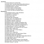
1920 Grinnell City Directory
“1920 Grinnell Directory: Arranged by Street Address,” compiled by Dan Kaiser in February 2008, arranged alphabetically by street name, includes surname, first name(s), house number, descriptor, and business, 60 pages
1930 Plat Book of Poweshiek County
“Plat Book of Poweshiek County, Iowa, 1930,” published by W. W. Hixon & Co., available from Iowa Digital Library, contains maps of the county and township maps showing land ownership, 18 images
1938 Plat Book of Poweshiek County
“Plat Book of Poweshiek County, Iowa, 1938,” published by Stacy Map Publishers of Rockford, IL. Contains maps of the county and township maps showing land ownership.
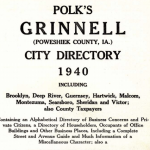
1940 Grinnell City Directory
“Polk’s Grinnell (Poweshiek County, IA.) City Directory, 1940,” from R. L. Polk & Co., including a written introduction, abbreviations, alphabetical list of names, and other information like churches, city government, libraries, state officials, and other city information, 191 pages
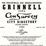
1962 Grinnell City Directory
“Grinnell Iowa Con-Survey City Directory, Master Edition, 1962,” from the Mullin-Kille Company and the Grinnell Herald-Register, includes written introductory material, images (including portraits), alphabetical list of businesses, a telephone directory, and residents listed alphabetically by street name, then number, 234 pages
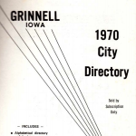
1970 Grinnell City Directory
“Grinnell, Iowa, 1970 City Directory” from Johnson Publishing Company, Inc., includes abbreviations, alphabetical list of names, churches, city officials, business directory, clubs and organizations, county officials, general information, history, telephone directory, schools, and street and avenue guide, also includes some images, 187 pages
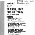
1972 Grinnell City Directory
“Grinnell, Iowa, 1970 City Directory” from Johnson Publishing Company, Inc., includes abbreviations, alphabetical list of names, churches, city officials, business directory, clubs and organizations, county officials, general information, history, industries, schools, street and avenue guide, and telephone directory, also includes some images, 214 pages
1975 Grinnell City Directory
“Johnson’s 1975 Special Residential Edition of the Grinnell, Iowa City Directory,” from Johnson Publishing Company, Inc., includes abbreviations, alphabetical list of names, chamber of commerce, churches, county officials, business directory, clubs and organizations, county officials, history, index to advertisers, schools, state and federal officials, and vital statistics, 173 pages
